Although our original reason for visiting Greendale Tarn didn’t pan out - it’s not a good place for wild swimming, more on that later - it turned out to be a wonderful spot in and of itself. The tarn is gorgeous, nestled in stunning mountain scenery and the walk to get there has some truly fabulous views, not to mention you spend a significant portion of the trail following a beautiful gill.
Added to that, it’s a quiet track, and we got the tarn to ourselves on a stunning summer’s afternoon. And if you really want to take a dip, there are some shallow plunge pools along the way, which we’ll detail below.
Here’s everything you need to know about the walk to Greendale Tarn.

The walk to Greendale Tarn
The stats
Distance: 1.4 miles each way (2.3km)
Elevation gain: 350m
Difficulty: Moderate
Summary: The walk to Greendale Tarn is uphill for the majority of the way. The path is rough in places, and the final stretch to the tarn is boggy (although completely flat).
I was somewhat nervous about descending on the uneven terrain, but luckily as the ground was dry, it actually wasn’t slippery at all. I think it could be pretty slippery when wet though.

Starting the trail
From the parking area (details below) the walk starts as it means to go on, up a hill. However, the path is pretty good along this first stretch and the views are wonderful.
The path is a mix of grassy track, stone steps and some loose rock (most of which can be avoided by skirting the edge).


After 250m you’ll see a fork in the track, keep on the main trail and do not take the turn onto the minor trail that goes left. We took it on the way up to Greendale Tarn and it’s much steeper and a bit rougher than keeping to the main track on the right.
We descended on the main trail and would definitely recommend using this one both ways.

The hill does get a bit steeper as you continue, but after 650m (where the two trails re-join) it will begin to flatten.
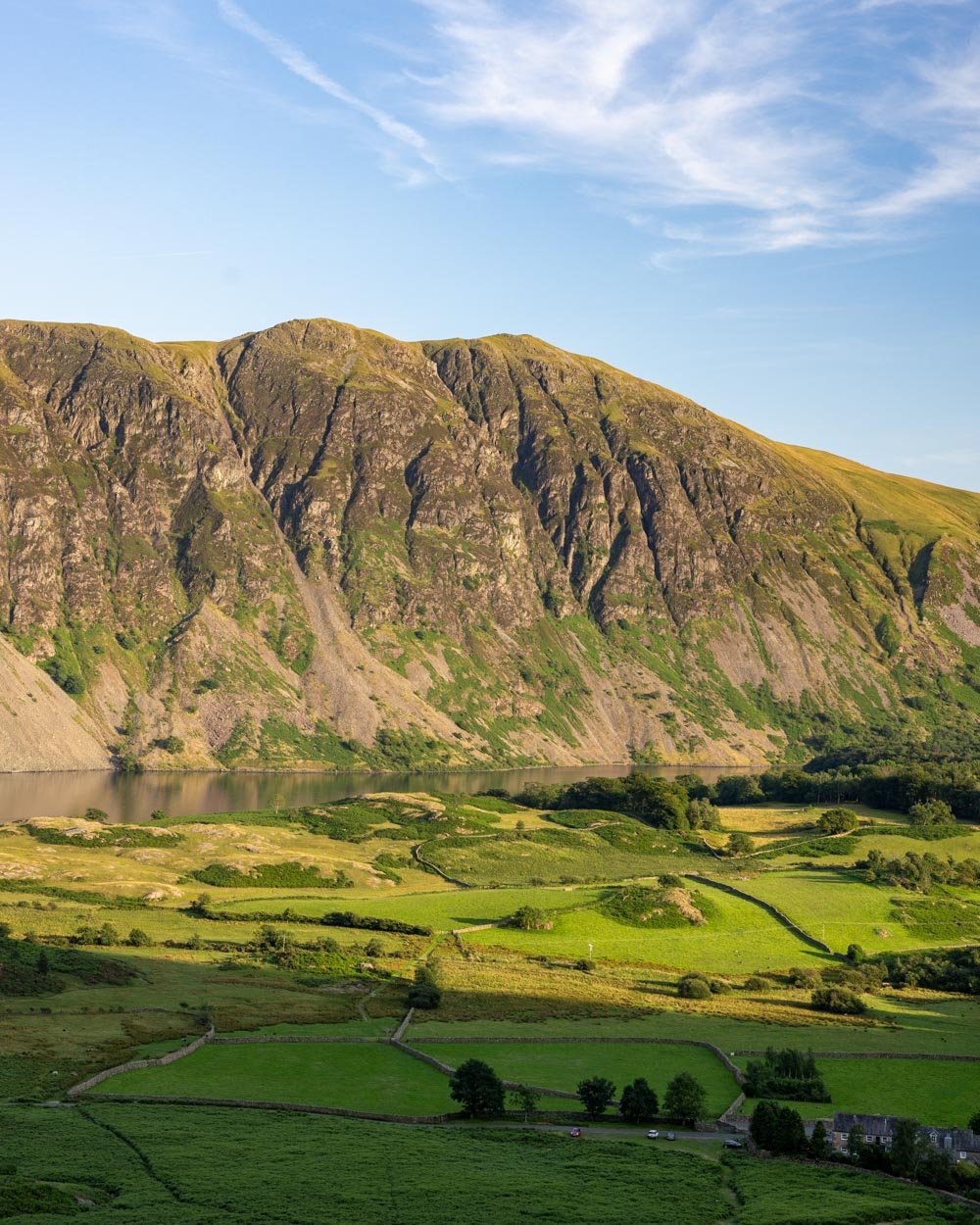
Keep looking behind you to see the ever more sensational Wastwater views.


To the plunge pools
You’re now following a narrow gravel path which is predominantly flat. You’ll start to hear the gill beneath you and get some good views of the rolling hills ahead.
After 300m (950m from the parking area) you’ll see an area where it’s possible to easily cross over the creek.


There are lots of rocks to use as stepping stones, providing the rainfall hasn’t been too crazy and submerged them.
This is the best point at which to cross if you want to go for a dip in some of the secluded pools along Tongue Gill.

There are many pools, but none are big, and none I personally ventured into were that deep. However, if you’re here on a warm day and you want to relax in some shallow pools with spectacular views, then you won’t be disappointed.
The best pools are where the two gills converge. To get to them requires crossing the creek and walking downhill on the patch of ground between the two streams. It’s a very narrow ‘trail’ through the bracken.
You’ll then reach a prominent tree and can cross the pool on the left and take the grassy track down to the ‘main’ pools.

There are several more beyond which require a bit of rock hopping to access. Watch out for the gorse, which was prolific and very spiky!


As mentioned these are not swimming spots, but the surrounds are stunning and they’re good for lazing around in.
There are similar pools on Greendale Gill, just off the main trail, which are easier to access - but as they are literally beside the path, they don’t have that same secluded vibe.
After visiting Tongue Gill you retrace you steps back onto the main path using the creek crossing to continue up to the tarn.

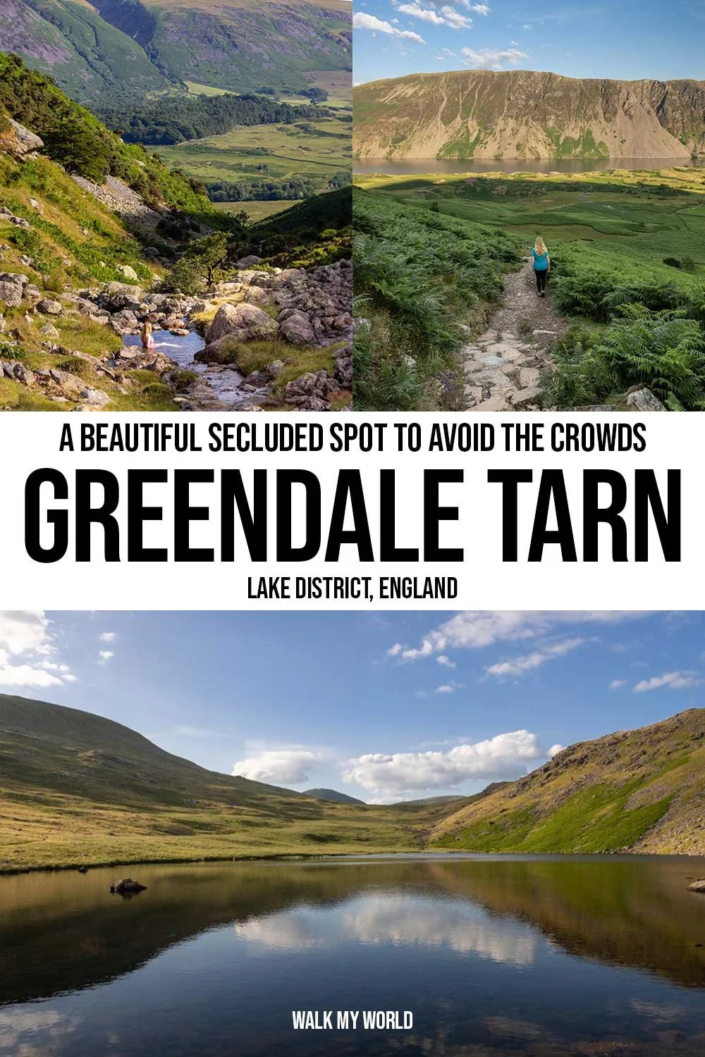
Following the cascades
Even if you’re not interested in the pools on Tongue Gill, you might still want to cross the creek to get a closer view of the slender waterfall directly ahead of you, on the other side of the creek.
You can cross to get much closer to it, but it’s not overly powerful unless there has been a lot of rain. The path to get there is narrow and slightly sloped, but easy enough when dry.

If you don’t want to visit the small pools of Tongue Gill, or get a closer look at the waterfall, then you would not cross the creek at all on this walk.
You would simply continue on the main path, heading uphill. You will now be following Greendale Gill, which has some small pools of its own. There are a long series of cascades, which are very pretty.
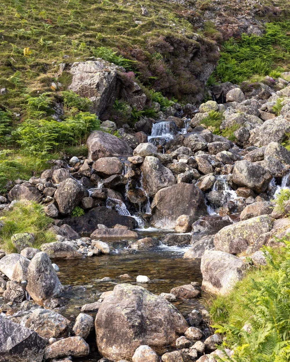
The path is less steep along this next section, but a bit rockier. It was a few bits along this next stretch that I thought might be hard to descend, but were actually totally fine.
Everything was more stable and grippier than it looked, although I did watch my footing most of the way. The path can be indistinct at times, and I just picked the route that looked easiest.

The bog traverse
Roughly 600m after the area where you can cross the creek to Tongue Gill, you’ll start to notice some boggy ground, but there are still rocks here to avoid it. However, 50m later the path will all but flatten and the real bog will commence.
Bog aside, this is a lovely stretch of track as it’s flat and leisurely and the craggy fells and wide open space give it a wild feel. On the way back, or if you look behind you, you’ll actually be able to see the sea from here!


Unfortunately even when we walked in summer the bog was ever present and we did get wet boots. It wasn’t “suck your boots off” bog, but it was enough to get wet and squelchy socks.
The tarn is 550m away from when you get to this boggy grassland and whilst it’s not wet the whole way, it was for a significant portion.

Reaching Greendale Tarn
You will reach the shores of Greendale Tarn 1.4 miles (2.3km) into the walk (that is if you haven’t made the short detour to Tongue Gill).
It’s a really beautiful spot, especially in the late afternoon light. We were lucky that the wind dropped and we got some lovely reflections on the water.


The tarn has a wonderful remote feel and though it’s not surrounded by the biggest fells in the Lakes, they are very atmospheric. There are some good large rocks to the right of the tarn, which make for a fabulous place to sit and enjoy the view.

As mentioned at the beginning of the post, my initial reason for visiting the tarn was to take a dip. Unfortunately, unlike places like Easedale Tarn (which is brilliant for swimming), Greendale Tarn is not.
It’s very shallow, and to reach water deep enough to even attempt to swim involved negotiating far too many very slippery and uncomfortable rocks.

Although it would be a magical little swim spot if this were not the case, there are far better tarns that are easier to access and much better for swimming than this one.
I would say it’s really not worth trying here unless the water levels are far, far higher than when we visited.


You could walk all the way around the tarn if desired and even climb Middle Fell if you wanted to lengthen the trail. If not you would simply retrace your steps back down to the car park again.
Parking for the Greendale Tarn Walk
Although there is no car park as such, there is a decent amount of room for cars to pull right off the road at Greendale. The parking area is a little east of Greendale Gill - it’s the road that runs between Wellington and Wasdale Head, you can find the exact spot by clicking here - and it’s free of charge.
The parking area is 38 miles (1 hour 10) from Keswick, 35 miles (1 hour 25) from Ambleside and 25 miles (1 hour) from Cockermouth.
This post may contain affiliate links, meaning at no additional cost to you, we will earn a small commission if you click through and decide to make a purchase. This helps towards the costs of running our website. Thanks for your support.