

Castle Crag might be one of the smaller Lake District fells, but it’s got one of the most interesting summits. As well as gorgeous views, you’ll find the remains of an old quarry. If you opt to take the slightly longer route on the way back you’ll also have the chance to visit a hidden cave, which was once the summer home of a legendary Lake District adventurer for over 50 years!
For a walk that can easily be completed in less than two hours, it’s a great option when you only have a short weather window - which let’s face it, is pretty often in the Lakes!
Here’s everything you need to know about the Castle Crag walk, as well as how to find the hidden cave.

Wainwright and Castle Crag
Castle Crag is a little outcrop on the side of High Spy, a large fell in the Borrowdale Valley. It’s a summit that’s easily missed if you’re driving through Borrowdale, primarily due to its small stature in comparison to the surrounding fells and the fact that it’s covered in trees.
However, this all added to why Wainwright loved it.
“Castle Crag is so magnificiently independent, so ruggedly individual, so aggressively unashamed of its lack of inches, that less than justice would be done by relegating it to a paragraph in the High Spy chapter….
Castle Crag conforms to no pattern. It is an obstruction in the throat of Borrowdale, confining passage therein to the width of a river and a road, hiding what lies beyond cultivation… Naked of trees, Castle Crag would be ugly; with them, it has a sylvan beauty unsurpassed, unique.”
Alfred Wainwright, "A Pictorial Guide to the Lakeland Fells, Book Six: The Northwestern Fells

He goes on to describe this area as “the loveliest square mile in Lakeland”. With a write up like that, you know you have to visit!
The Castle Crag Walk
The possible routes
Castle Crag can be walked via two routes, from Grange in the north and going up the western slope, or Rosthwaite in the south and going up the eastern slope. They are both similar in length and elevation gain, and both require climbing the final slate pile up to the top of the fell.
We chose to walk from Rosthwaite.
The Castle Crag loop from Rosthwaite
The stats
Distance: 4.2 mile loop (6.8km)
Elevation gain: 275m
Difficulty: Moderate
Summary: The Castle Crag walk has a fairly steep ascent if walked via the most direct route from Rosthwaite, however, it’s all on a well maintained trail. Only the last 140m are on a very steep track up a big slate pile (you have to walk this bit from whichever direction you come).
This would be very slippery when wet, but is better than it looks when dry! If you complete the circuit rather than returning the way you came, most of the descent is very gradual.

Starting the trail in Rosthwaite
From the car park (details below) you’ll turn right and after 75m you’ll pass the tiny ‘Flock In’ tea room and then pass through Yew Tree Farm.
You’ll reach a wide stony path which is flat and has some nice fell views.

Approximately 450m into the trail you’ll begin heading alongside the river and 300m later come to a picturesque old stone bridge.
After crossing the bridge, head right and you’ll come to two gates 70m later. You need to take the gate on the right, and the trail will continue alongside the river.


The climb begins
You’ll follow the riverside path for 230m before you’ll come to a trail heading gently uphill to the left. Following our route, which is the quickest route to the top, you need to head through the gate that you’ll see directly ahead of you.
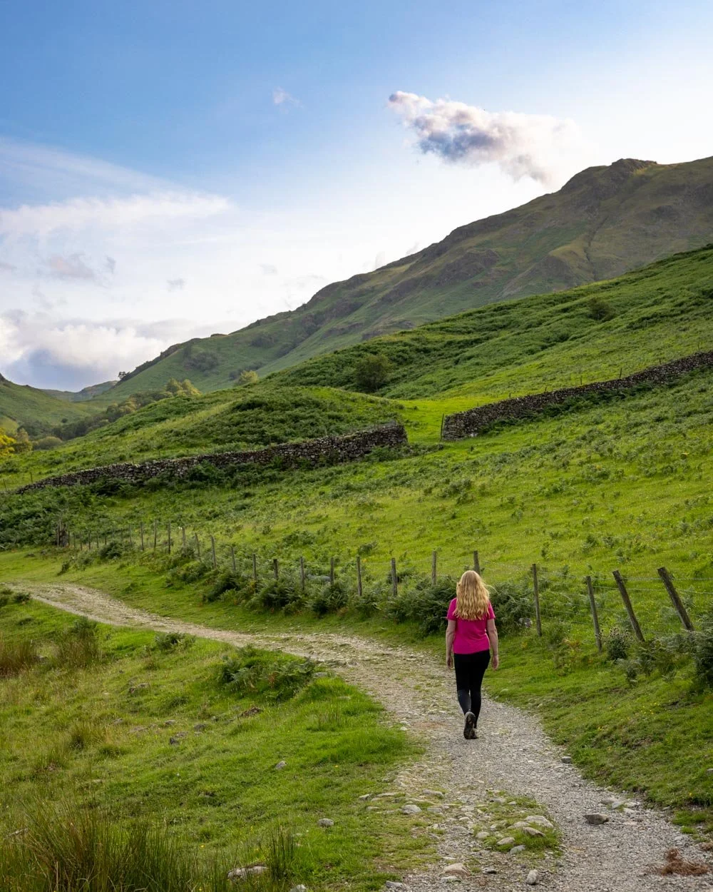
There’s a narrow gravel/dirt track which begins taking you quite steeply uphill once you’ve passed through the gate. As you climb the views get better and better, with green fields backed by rolling hills.
The climb does start to get steeper, but it’s not slippery when dry and it’s easier going uphill than it would be to descend this way.


Roughly 200m into the climb you’ll reach a series of stone steps, which are still steepish, but definitely less steep than the gravel section.
After another 200m and 1.6km (1 mile) into the walk you’ll pass through a gap in the drystone wall and 150m later you’ll come to a large stile. From here you can see the slate pile just ahead of you.

Reaching the Castle Crag quarry
Just a couple of minutes beyond the stile you’ll begin climbing up the slate pile. This section is 140m long and there’s a narrow gravel path which zig zags up the heap.

On the way up it isn’t too slippery, and only one of the zigzags is particularly steep. I did find this steep section a bit unnerving going downhill, but it’s probably only around five steps and the uphill is fine.
However, we were walking in dry conditions, I do think it could be pretty slippery when wet.


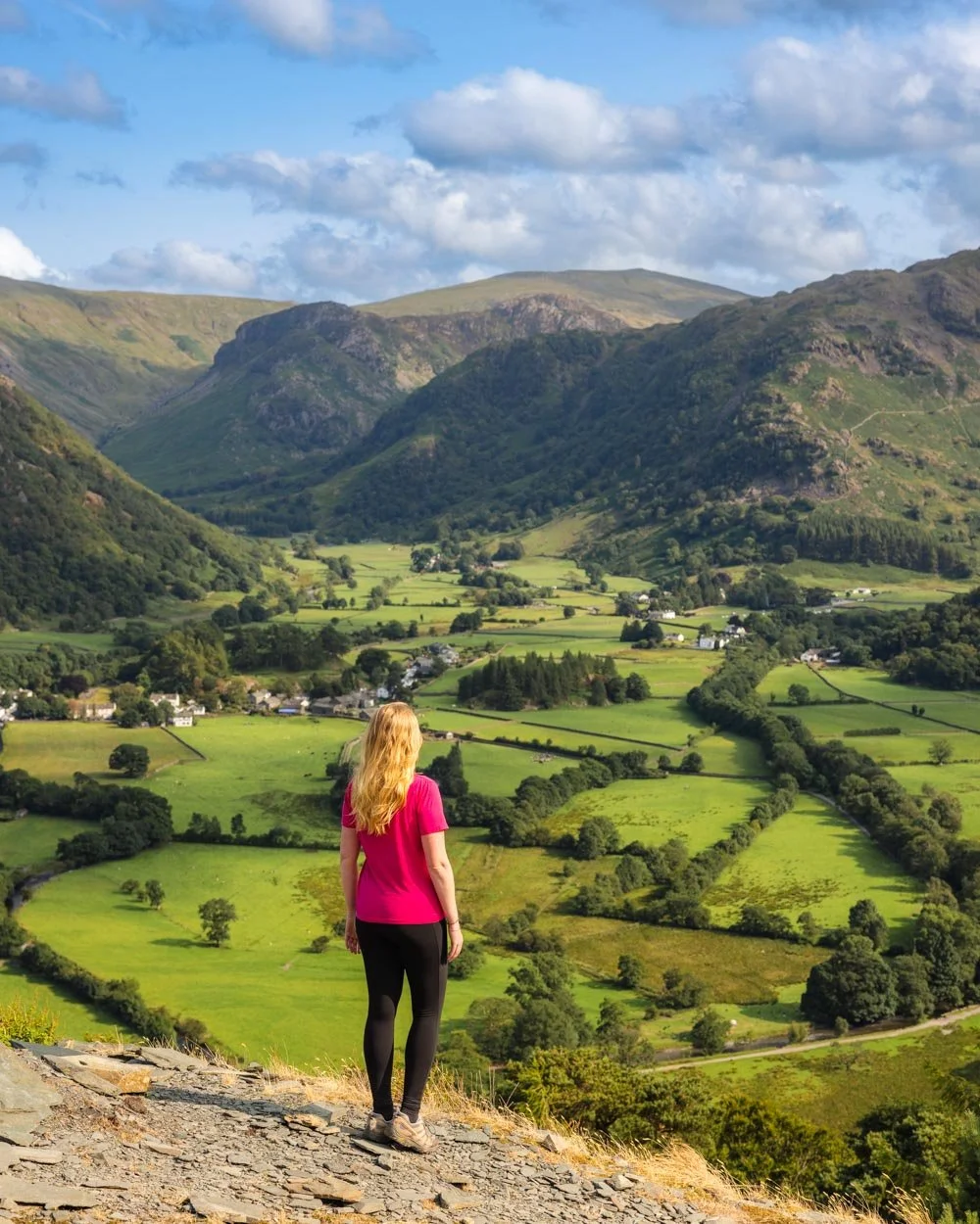
You’ll reach the top of the slate pile 1.9km into the walk and the area to the right offers my favourite view of the whole trail.

You can then explore the quarry remains to the left, which are what makes this fell so dramatic, despite its small size.
The jagged quarry walls are very atmospheric and you can walk for roughly 150m through the quarry, following the obvious path.


The path doesn’t really end at anything, but it’s definitely worth exploring before you head to the official summit.
The top of Castle Crag
The official top of Castle Crag is 150m beyond the slate pile - you’ll see the path leading uphill through the trees (before the quarry area).
It’s a more rustic track, with some rocks and tree roots to climb over, but it’s easy enough. You’ll then head along a flatter path that takes you gently up to the memorial stone, which marks the top of the fell.

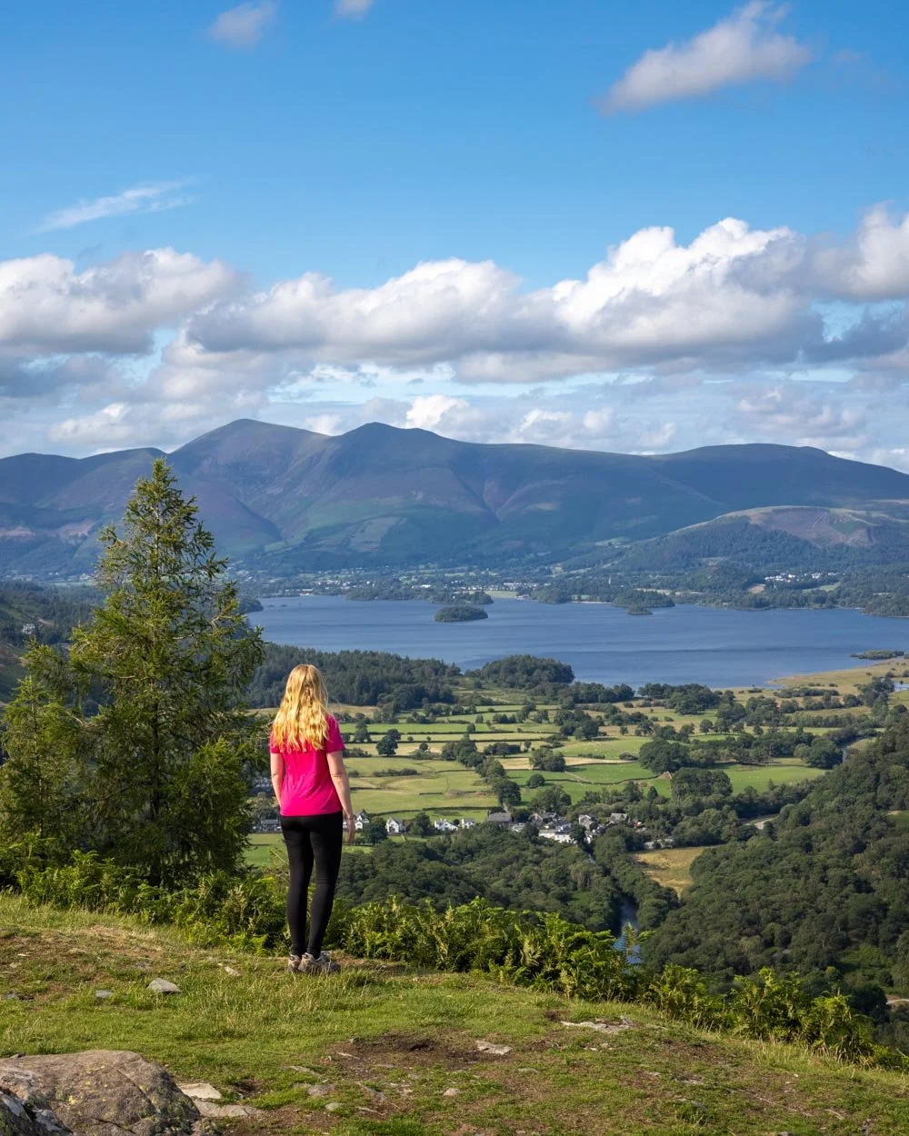
You’ll now have views on the other side of the valley, looking out over Derwent Water. You can also look down into the quarry from above, which makes for an interesting perspective.
Although I like the lower level better, it’s still great views from the top.

Descending from Castle Crag
From here you have a choice of taking the scenic loop track (which includes visiting the caves) or heading directly back to Rosthwaite on the path you came up on. Both the direct route and the circular route head back down the slate pile when descending from Castle Crag.
Descending the slate pile is a bit harder than ascending if you’re like me and not always steady on your feet, but only the steepest zigzag felt noticeably slippery.

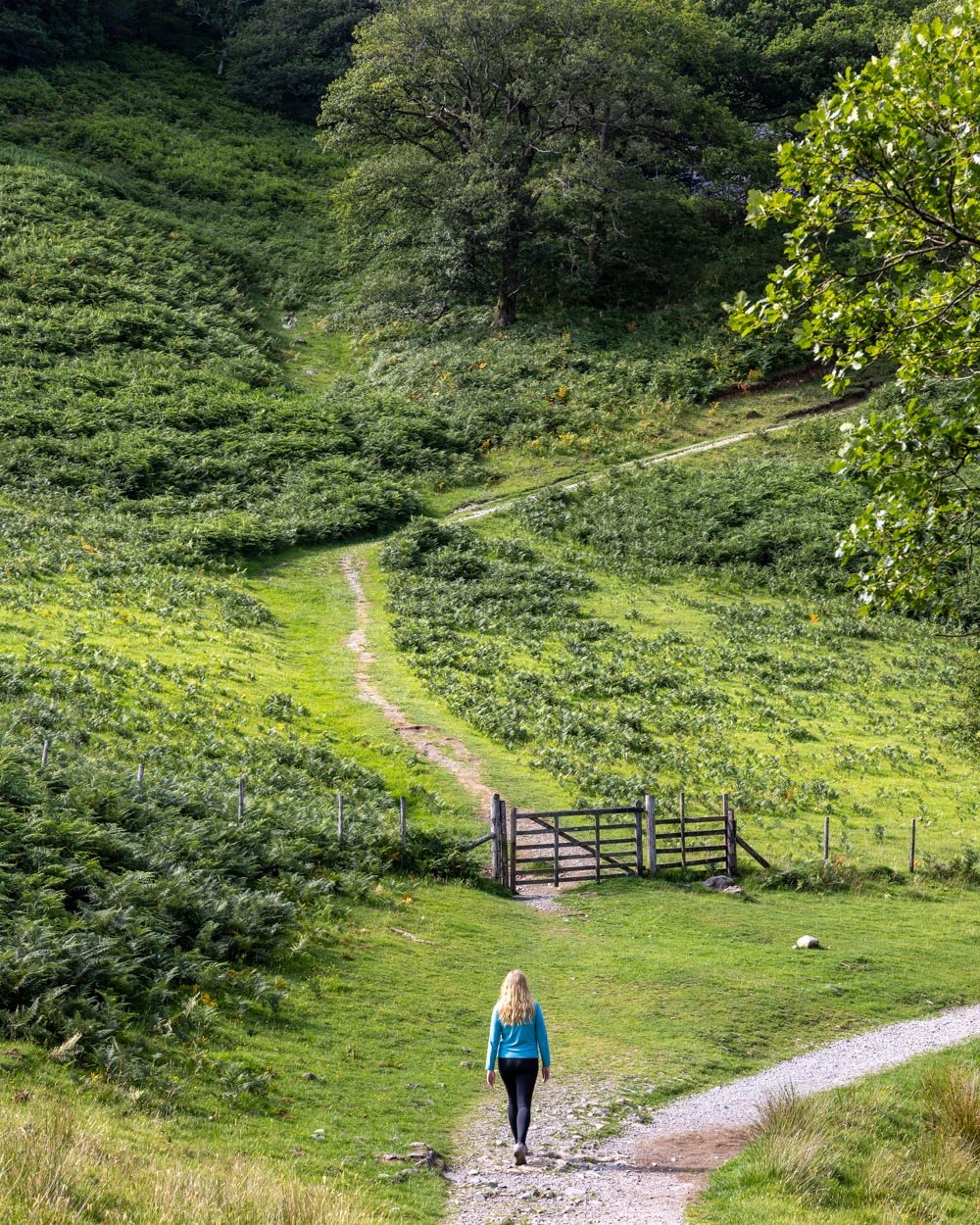
If you have a bit of extra time, rather than retracing your steps - which is a much steeper descent route - we’d recommend taking the path leading downhill to the right, 100m after the slate pile (before the stile). This will take you on the loop track which goes via the caves.
The first 50m are a touch steep on rough stairs, but nothing like the ascent route and the path is pretty good. The descent then slackens and becomes a stony track.


Continuing on the obvious path it will soon curve round and this is where you start to get some great views looking down the valley, with steep cliffs on either side of you. You can see Castle Crag above and it already looks so far away, which is surprising because the descent is gentle.
The path is a bit rocky, so it’s not always the most comfortable underfoot, but when dry it’s not slippery.

Finding the hidden cave
Roughly 800m into the decent you’ll come to a small wooden bridge. You want to head right, over the wooden bridge and continue along the shady track.

The path flattens and becomes smoother underfoot. Just 200m beyond the bridge you’ll see a sign for Rosthwaite and follow it, heading right.
You’ll begin following the river and though it looked pretty shallow from above, we saw a rope swing and you could head down the riverbank into the water. There was easier river access a little further along the path as the trail actually drops you down to the water, but it did look even more shallow here.
You’ll follow the pretty riverside track for around 400m before coming to High Hows Wood. The path is generally flat, although there are a few undulations along the way.

Roughly 750m beyond the Rosthwaite sign you’ll come to an un-signposted junction and this is where you need to turn off the main trail to find the cave.
Take the path leading right - there are actually two paths on the right and both will take you there. The one that is more straight ahead than a hard right is the gentler route and takes you via a second cave.
Millican Dalton’s Cave
If you’ve taken the shallower route, you’ll climb gently uphill for 100m before coming to the first cave. This a smaller cave and relatively open, but worth a quick look around.

The first cave
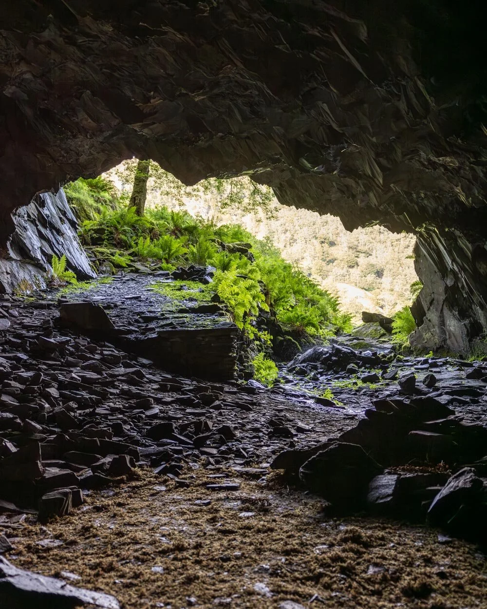
From here you’ll see a path continuing uphill to the right of the cave and 100m later you’ll arrive at the entrance to Millican Dalton’s Cave.
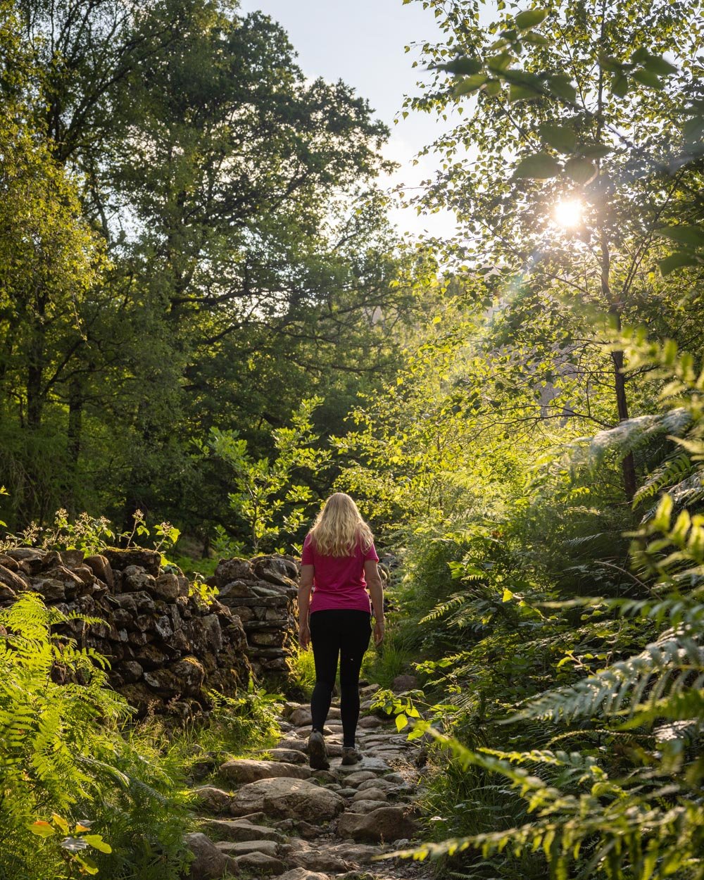
The path up to the cave is easy when using this route. It’s an atmospheric entryway, with the wide cave mouth and bracken lined path leading towards it.

You can’t see into the cave at this point and it feels like you will walk straight into a black abyss!
It takes a minute or so to reach the cave mouth and if it’s been wet recently you’ll be met with a small dripping waterfall. The water droplets hitting the slate was the only sound inside the cave which created an eerie atmosphere.


Once inside the cave (it’s easy to get in as there aren’t any rocks to climb over) you can look back on the cave mouth, which has similar jagged rocks to Rydal Cave which give it a dramatic feel.

The cave has a second opening to the left and it’s actually pretty big inside. I can’t say it looks like an ideal holiday home, but it’s a fun place to have a poke around!
There’s a sign outside saying not to light fires, so please respect the cave and leave it exactly as you found it.

When it comes to the history of the cave (which is technically a quarry), it was used as a summer home by Millican Dalton for almost 50 years, beginning in the 1920’s.
Dalton wasn’t born and bred in the Lakes, but fell in love with it during his 30’s and decided to leave the traditional life behind him. He spent summers in the Lakes and winters in a shack in Buckinghamshire.
The quarry became nicknamed the ‘Castle Crag Hotel’. Dalton led climbing and walking trips over the summer, sharing his love of the great outdoors with visitors.
Completing the circuit
When descending from the cave, you can either retrace your steps, or take the route you’ll see leading left, instead of right after exiting the cave.
This is a shorter, but steeper descent and one section has some loose soil, which can be a bit slippery. We took the steeper track but if it’s wet, I would recommend retracing your steps instead.
You’ll then arrive back at the trail junction where you turned off to see the first cave. You now head along the main track and follow it for 200m before you’ll come to a third cave, just a few seconds off the main trail and impossible to miss. It’s more of an arch than a cave really, but you can walk a little way inside.

After checking out the arch you continue along the main path, which is all on good terrain for the next 600m. At this point you will be back at the junction where your initial climb to Castle Crag began.
From here you retrace your steps along the river for 0.7 miles (1.2km) back to the car park.
Getting to Rosthwaite
Rosthwaite is a small village located in the valley of Borrowdale. It’s a 20 minute drive from Buttermere, less than 20 minutes from Keswick and 50 minutes from Ambleside.
If you don’t have a car you could also catch a bus to the village from Keswick, which has a regular service (78 Borrowdale Bus or 77A) departing from outside Booths supermarket. The journey time should be about 20-25 minutes.
Where to park for Castle Crag
The parking for Castle Crag using our route is at Rosthwaite, postcode CA12 5XB. There are two car parks, one is run by the National Trust and one is run by the Borrowdale Institute. If you’re an NT member, you’ll obviously want to park there as it will be free, but otherwise you’ll want to try and grab a spot in the Borrowdale Institute.
The cost is £5 for all day parking, which is the same price as the NT charges for 2 hours parking (all day parking there is £8.50). Although you can easily complete the Castle Crag walk in 2 hours, it’s nice not to feel rushed.
The Borrowdale Institute car park is tiny though, so you may end up at the NT one by default.
It’s possible there is some free parking somewhere further back from the trailhead, but we didn’t notice any.
The NT car park has toilets which you won’t find anywhere else along the trail.
This post may contain affiliate links, meaning at no additional cost to you, that we will earn a small commission if you click through and decide to make a purchase. This helps towards the costs of running our website. Thanks for your support.


